The mystery of wiltshire’s nine mile river
For locals in Salisbury, Amesbury, and Bulford looking for an off-the-beaten-path walk, this "Cinderella chalkstream" provides a fascinating glimpse into the unique geology and history of our region.
Wiltshire is a county defined by its chalk streams, ancient monuments, and the vast, rolling expanse of Salisbury Plain. Yet tucked away near the eastern edge of the Plain lies a lesser-known waterway with a name that raises more questions than it answers.
The Nine Mile River is a quiet tributary of the River Avon, offering a peaceful escape for walkers and history enthusiasts. But despite its name, this river is not nine miles long.
A Name That Doesn’t Quite Add Up
The most immediate curiosity surrounding the Nine Mile River is its length. At approximately four and a half miles, it falls far short of what its name suggests.
So why “Nine Mile”?
Local historians and geographers generally point to two main theories. The first suggests that in the era of horse-drawn travel, the river was crossed nine miles into a journey north from Salisbury through Bulford. The second proposes that its confluence with the River Avon occurs roughly nine miles upstream from Salisbury.
Whichever explanation is correct, the river’s identity is closely tied to the historic routes radiating from the cathedral city of Salisbury.
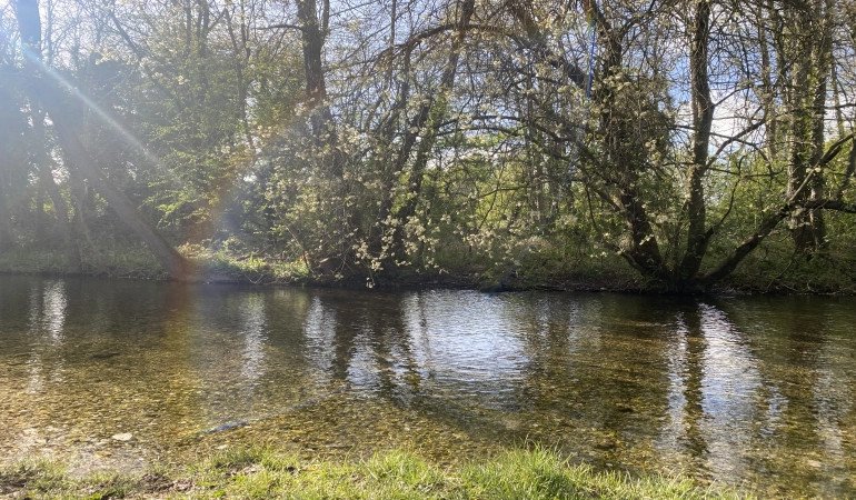
A Seasonal River: The Winterbourne Landscape
The Nine Mile River is a classic winterbourne a chalk stream that flows only when winter rainfall raises the groundwater table.
Its headwaters rise from springs below Brigmerston and Figheldean Downs, near Brigmerston Plantation. In summer, much of the upper channel is often dry, exposing flint gravels shaped by seasonal torrents. In winter, however, the river transforms, reappearing as rainfall saturates the chalk landscape.
The valley itself is strikingly different from the drier expanses of Salisbury Plain. Instead of pale grassland, it becomes a damp, lush corridor of springy green vegetation and soft ground.
With a gentle drop of only around 20 metres over its full course, the river flows slowly and meanders towards its meeting point with the River Avon at Bulford.
Walking Through History
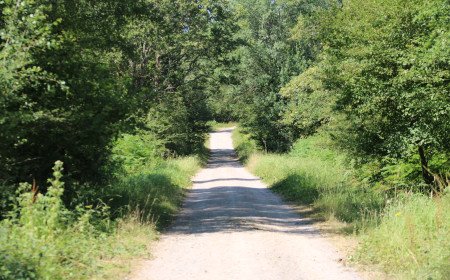
Exploring the Nine Mile River offers more than just natural beauty. Much of its course lies within or near the Salisbury Plain Training Area, meaning walkers must stick strictly to public rights of way and observe all military notices.
Despite these restrictions, the surrounding landscape is rich in historical interest:
- Ancient tumuli: Near the approach to Bulford, a cluster of nearly twenty burial mounds sits close to the valley, hinting at thousands of years of human activity.
- Historic milestone: An old milestone along the route records distances to Salisbury and Marlborough, with faint inscriptions referencing Hungerford and Sidbury Hill.
- The “one-way byway”: The old road running alongside the river has eroded into a deep, trench-like track. Locals sometimes refer to it as a “one-way byway,” as it is effectively only navigable westward.
- River fords: Several crossing points still cut through the valley, including one on the old Marlborough–Salisbury route. Even in summer, these fords can hold unexpected depth.
- Bulford Leas: As the river approaches Bulford, it passes under Sheep Bridge and enters a damp, wooded landscape known as Bulford Leas, where water lingers in the ground year-round.
A Quiet Ending in Bulford
The river eventually slips behind the houses of Old Coach Road in Bulford, passes under the High Street bridge, and splits into channels before joining the River Avon.
For those willing to follow its subtle path, the Nine Mile River offers a rare combination of ecology, history, and quiet mystery. It is a reminder that even the smallest waterways in Wiltshire carry deep stories shaped by landscape and time.
And when winter rains return, the dry valley comes alive again revealing a hidden river that is never quite what its name suggests.


Comments (0)